Platform for the identification of optimal places for water harvesting in the Central American Dry Corridor.
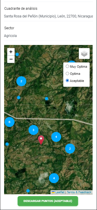
Cosecha H2O is a powerful web-based app developed by Digital Acceleration Partners in collaboration with CATIE to help farmers in the Central American Dry corridor harvest water more efficiently. Inspired by a GIS plugin, the app uses a combination of digital elevation modeling, land cover analysis, and soil type data to identify areas with the highest aptitude for water harvesting.
The app is designed to be intuitive and user-friendly, with a clean interface that makes it easy for farmers to access the information they need. By inputting data about their location, the app provides farmers with detailed information about the terrain, including elevation, slope, and aspect. It also analyzes land cover data to identify areas with high potential for water harvesting, such as forests, grasslands, and wetlands.
Using this information, farmers can make informed decisions about where to focus their water harvesting efforts. They can identify areas where water can be stored, such as depressions and natural ponds, and use the app’s soil type data to determine which crops are best suited to each location.
One of the key benefits of Cosecha H2O is its potential to impact hundreds of thousands of families in Central America. By providing farmers with a powerful tool for water harvesting, the app can help to improve crop yields, increase food security, and reduce the impact of droughts and other climate-related disasters.
Overall, Cosecha H2O is an innovative and powerful tool for water harvesting in the Central American Dry corridor. Its combination of digital elevation modeling, land cover analysis, and soil type data makes it a comprehensive and effective solution for farmers looking to maximize their water resources and build a more sustainable future for themselves and their communities.


